
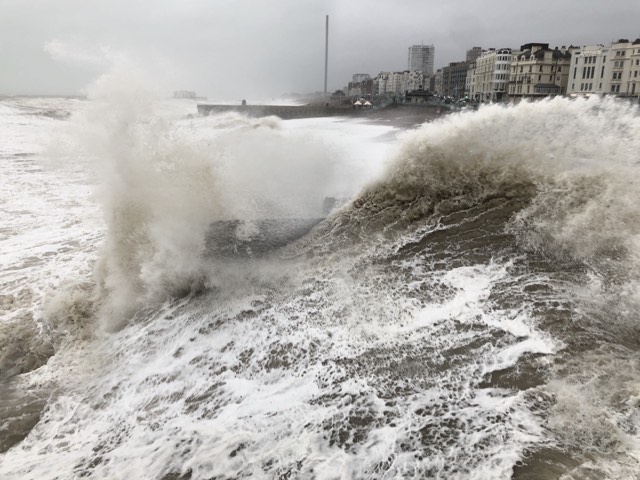
Storm Floris is heading this way although the full force is expected to be felt further north than in Brighton and Hove.
Even so, the Met Office predicted winds of up to 45mph could hit the south, with some rain – but, again, relatively little compared with the northern half of the country.
The official forecaster said that the first named storm of the summer should blow in on Monday (4 August), with the wind whipping up in the afternoon.
The exact track of the storm is hard to predict and it was blowing across the Atlantic today (Saturday 2 August) with the eye of the storm appearing to be on course for Scotland.
The Met Office said that, in the Atlantic, what had started as a band of heavy rain would be picked up by an active jetstream and turned into a storm, with a huge drop in pressure as it moved closer to the British Isles.
In places, the winds could gust at up to 85mph although, at the moment, the top speeds are likely to be around half that in the south. Travel could be disrupted.
The Met Office added that, with trees in full leaf at this time of year, they were more likely to be toppled with branches broken off than in winter when the wind can whistle through them.
Two years ago, Storm Antoni meant a wet and windy Brighton Pride, with Storm Betty following just a fortnight later.
The first real storm of the summer this year follows a fairly warm July – the country’s fifth warmest on record, according to provisional figures.
And, the Met Office said, last month was Britain’s sixth consecutive month of above-average mean temperatures.
Rainfall was a bit below average with South East Water bringing in restrictions and Southern Water asking customers to use water wisely.