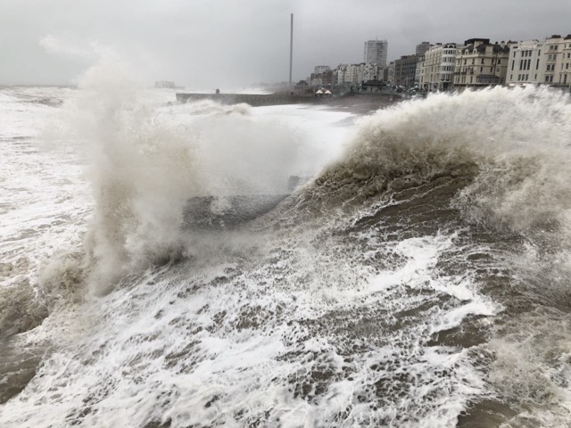
Heavy rain and strong winds will batter parts of southern England, western Wales, Northern Ireland and Scotland over the next few days, forecasters have said.
The Met Office issued six separate yellow weather warnings spanning Monday to Wednesday morning.
Winds in the south-west of England, including Cornwall and parts of Devon, could reach speeds of up to 60-65mph along some stretches of the coast.
The forecaster warned the strong gusts, scheduled to last until 6am on Tuesday, had a “small chance” of causing power cuts and damaging buildings.
A yellow weather warning for England’s southern coast, including Southampton and Brighton, says winds are expected to reach 45-55mph, peaking at 65mph in some areas before easing off from 9am on Tuesday.
Another yellow weather warning for Wales’ west coast has been issued between 1am and 3pm on Tuesday, when “a spell of strong winds” will affect the region with gusts reaching up to 65mph overnight.
In Scotland, 20mm-40mm of rainfall is expected in some areas between 1am and 6pm on Tuesday, while a few could see as much as 50-60mm.
Affected areas include Edinburgh, Glasgow, Perth and Aberdeen.
Further rainfall is forecast in western Scotland between 9am and 6pm on Wednesday and may cause flooding, with 15-25mm of rain expected to fall in most places and 40-50mm forecast on high ground.
Between 10pm on Monday and 6am on Tuesday, eastern parts of Northern Ireland are forecast to experience heavy rainfall of between 25-30mm.
The weather service warned rain and wind could cause disruption to rail and road travel across the country, as driving conditions worsen because of slippery road surfaces and limited visibility.
Met Office forecaster Simon Partridge said that while these levels of rainfall would not be a “huge cause for concern” on their own, they will fall onto “already saturated ground” which increases the risk of flooding.
Met Office provisional statistics showed that England saw a record amount of rainfall in the 18 months to March. Mr Partridge said the past three months in particular had made for a “very wet start to the year”.
In April, Storm Kathleen caused widespread travel disruption as hundreds of flood alerts were issued and thousands of homes lose power.
The Environment Agency currently has 213 flood alerts and 100 flood warnings in place in England, as of Monday evening.
Mr Partridge added: “We’ll continue with very unsettled weather as we head into spring, which is usually when we start to see things settle down a little bit more.
“We’re continuing with one area of low pressure after another, which is mainly down to the fact that the jet stream is a bit further south than it would normally be at this time of year.”
He said it would be a “blustery day” in England on Tuesday but there would not be “huge totals of rain”.
He added: “In many ways, the threshold for rainfall warnings is lower than it would be ordinarily just because the groundwater levels are so high at the moment.”
The second half of the week should be a “bit drier” with warm temperatures in the south of the UK, before returning to normal over the weekend, he added.
He said: “It’s actually quite warm conditions for the time of year – we could see 19C or 20C across eastern and southeastern parts of the UK come Thursday and Friday.
“But the north will always stay quite unsettled.”


This is the climate crisis in action.
Newspaper people – call it what it is.
It’s important to be truthful about what is down to the climate crisis and what is down to weather circumstances.
In this case, the overnight flooding is a sad result of the combination of strong wind, exceptionally high waves, and the storm surge which then coincided with a big Spring tide. The high water mark was always expected to reach 6.9m at around midnight last night, but that was without the extra surge caused by wind and waves.
So the river Adur burst its banks at Shoreham near the sailing club slipway, and flooded a short part of the seafront A259 – which older readers will know has been flooded many times before.
The river Arun also burst its banks and with more serious consequences, flooding out a holiday park and several homes near Littlehampton. Bracklesham and areas fronting onto Chichester harbour were also affected.
Storm damage in the West Country was even more extensive, after even stronger winds were experienced down there.
This was not unusual as a spring weather in early April, but the fast-moving system was bad enough to be named as storm ‘Pierrick’ by the French Meteo authority, because the Brittany coast was expected to see even stronger winds than here in the UK.
Where Climate Change comes into this is as the possible cause for yet another ‘El Niño’ year, which in turn has bought exceptional weather patterns across the world, with some areas experiencing unusual drought conditions, or heatwaves, whilst other areas have had endless rain. There’s a very strong argument that these seasonal fluctuations in our weather patterns are becoming way more frequent.
The rain last night was not particularly heavy during the storm but came after a very wet winter in the UK, and water meadows were unable to dissipate the flood water in many areas, and we might argue that too many of these water meadows have been built upon.
The neglected drainage system in our city streets was also little able to cope with flood water, on top of the rain we saw earlier yesterday evening. This ‘neglect’ is down to a privatised water company more interested in investor profits than in maintaining drainage infrastructure, plus the cash-strapped councils have failed to weed our streets or to clear the gutters and drain sumps – as they used to do.